Elm Fork Trinity Kayak Trips, Overview and Section Maps
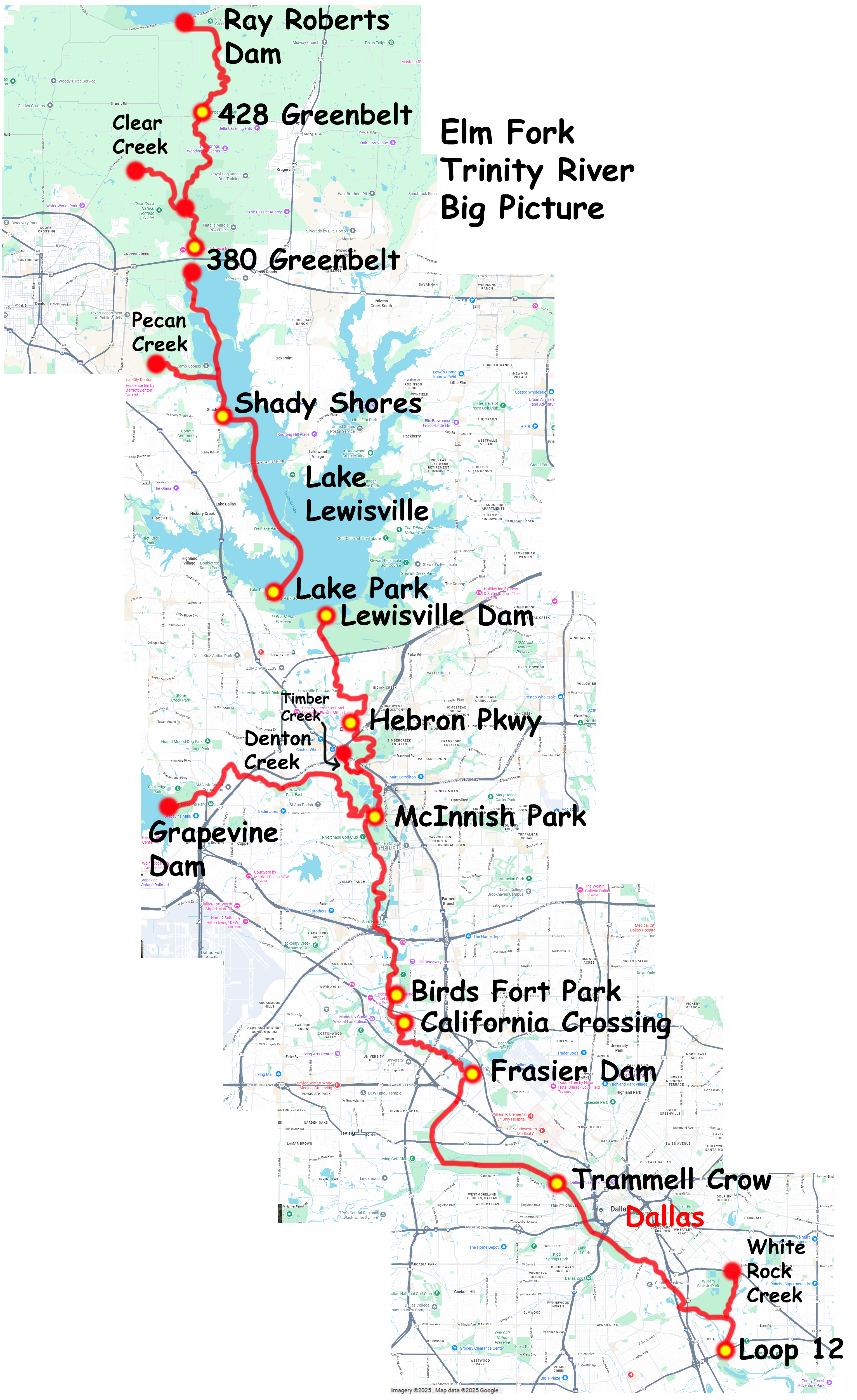
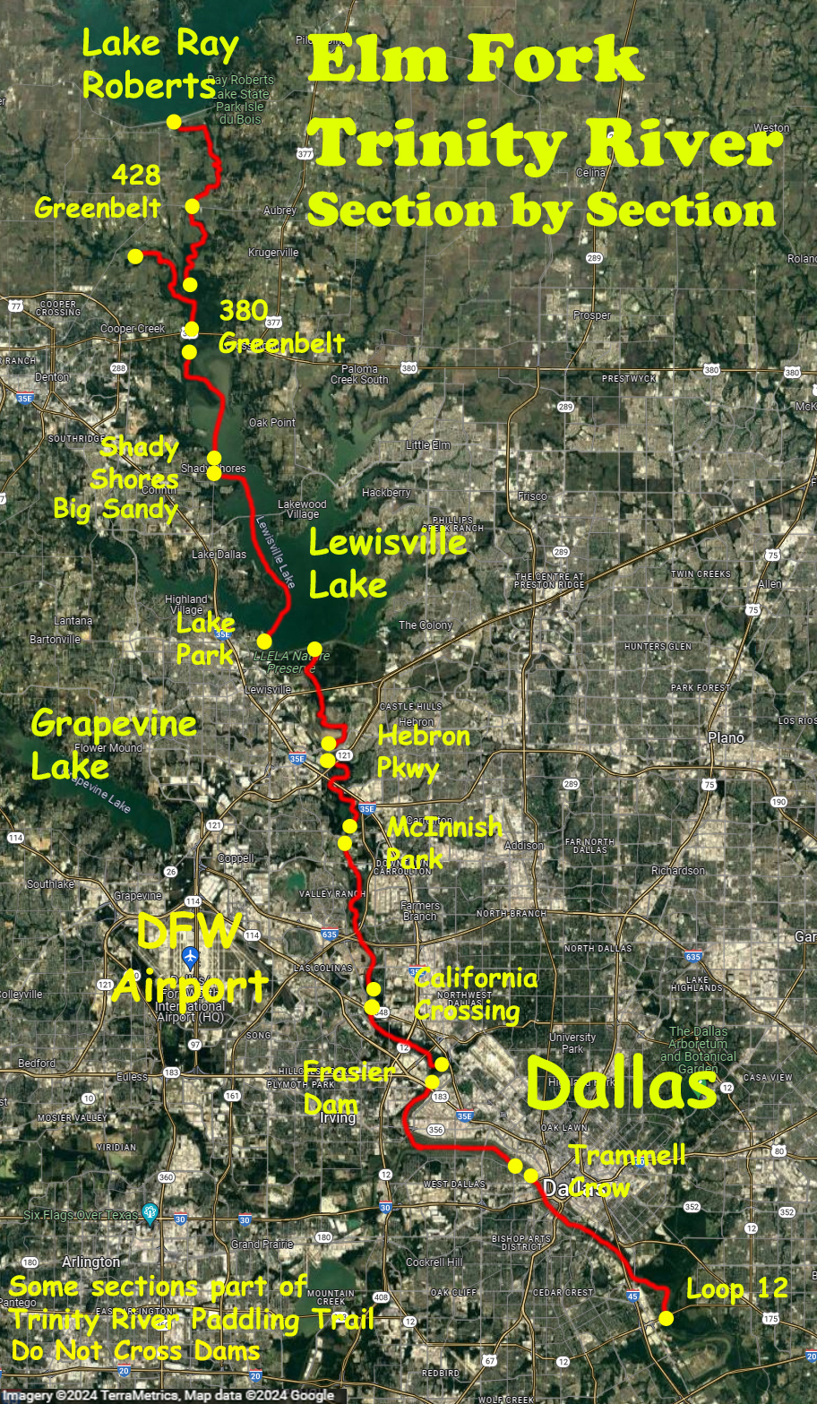
The maps above show a section by section overview of the Elm Fork of the Trinity River, from a paddling perspective, starting from just below the Ray Roberts dam to the Trinity River takeout on Loop 12 south of Dallas. Some trips include parts of White Rock Creek, Denton Creek, Timber Creek, Pecan Creek, Clear Creek and, in Dallas, the (main) Trinity. Posted below are individual section maps and a few comments. All the trips here are out-and-backs, but point to point trips are possible too using a couple cars. Some of the route sections are packaged as part of the Trinity River National Water Trail (link), which also includes the West Fork towards Fort Worth. Never go over or near any of the dams, they are dangerous. And paddling out into the big lakes like Lewisville or others should be avoided if possible as this requires experience and care. More kayak safety info is at the site, ‘Center for Cold Water Safety‘ (link).
Below, individual trips
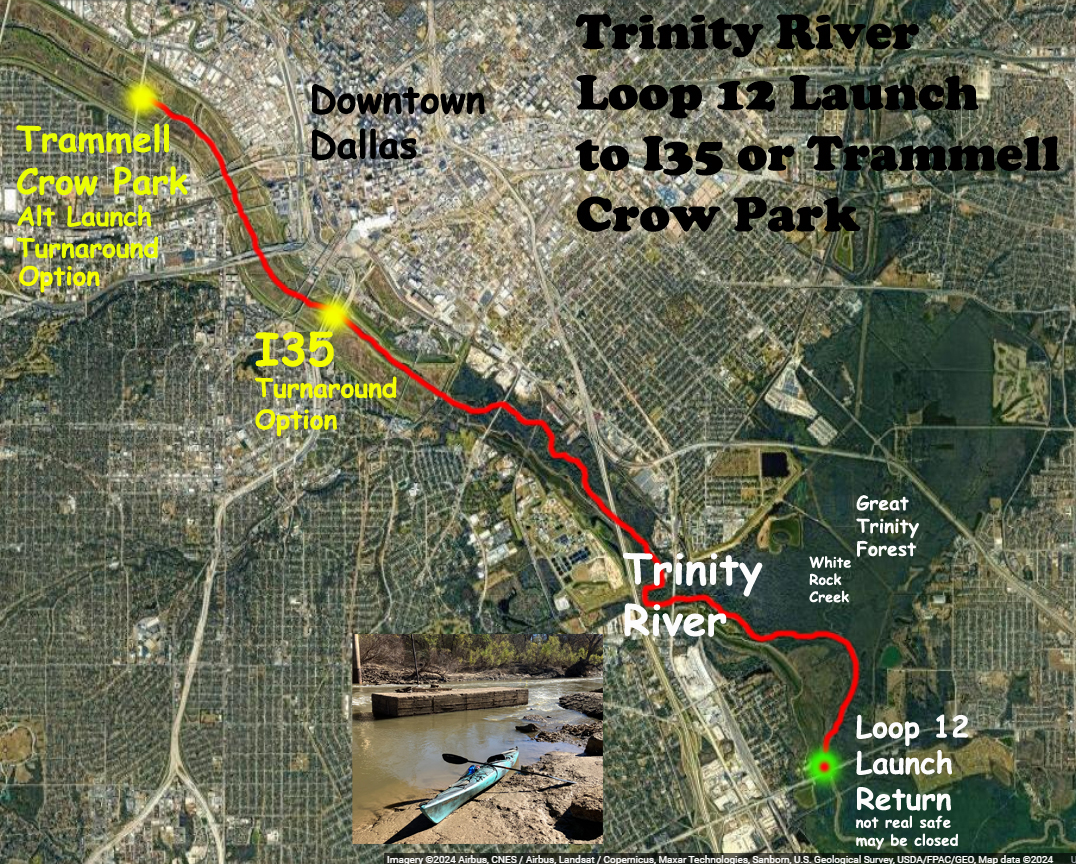
The Loop 12 launch on the Trinity just below Dallas lets you paddle up and back to the Interstate 35 bridge, or a bit further to the launch at Trammell Crow Park. Alternatively one can split to go up White Rock Creek which enters the Trinity near here after flowing downstream from White Rock Lake. This section really isn’t the Elm Fork per se, its the Trinity proper, but whatever. Note that the area under Loop 12 isn’t the greatest spot to leave your car, and the launch is sometimes gated and/or closed.
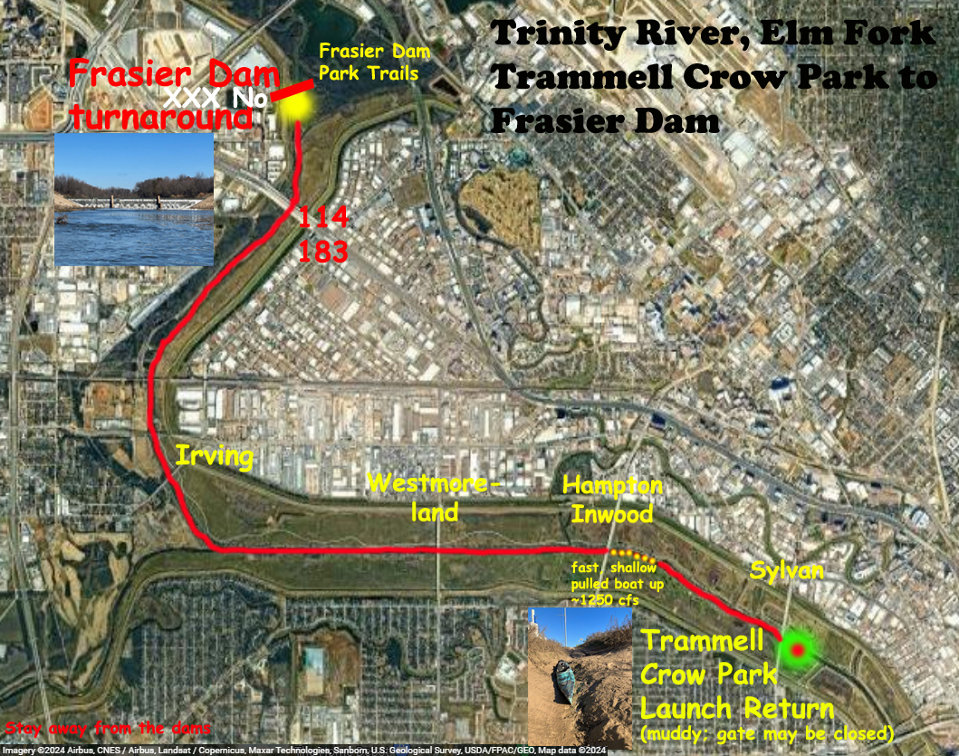
The launch at Trammell Crow Park was the most difficult I have ever done, ever; it was a thick mud slide, getting the boat out was beyond belief hard. Although the launch is sometimes gated it may still be open to non-motorized boats, hard to say. Edward Abbey said go ahead so I did. The trip is an out and back that starts at the Trammell Crow launch, goes up the Trinity River, splits to go up the Elm Fork of the Trinity, reaches Frasier Dam, and turns around for the return leg. Note that one section on the Trinity, just upstream of the launch, is shallow and flows pretty fast; there I had to get out and pull the boat upstream.
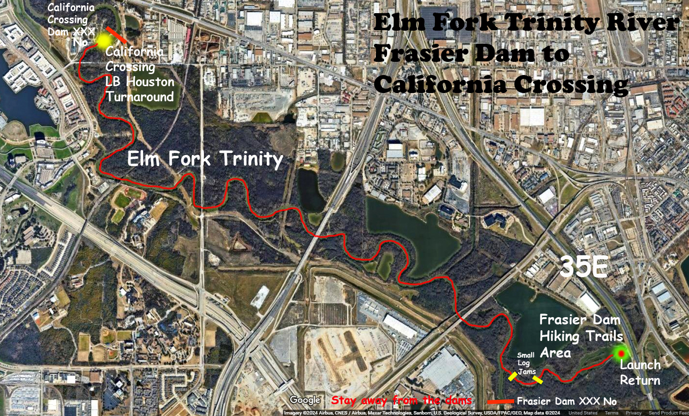
The launch for this section of the Elm Fork of the Trinity is at the “Frasier Dam Hiking Trails Area” right off of I35. It isn’t a super great area to park but no problems so far. The route is an out and back, going upstream to the California Crossing Dam, then turning around for the return leg. It is also possible to launch below the California Crossing Dam and go downstream first.
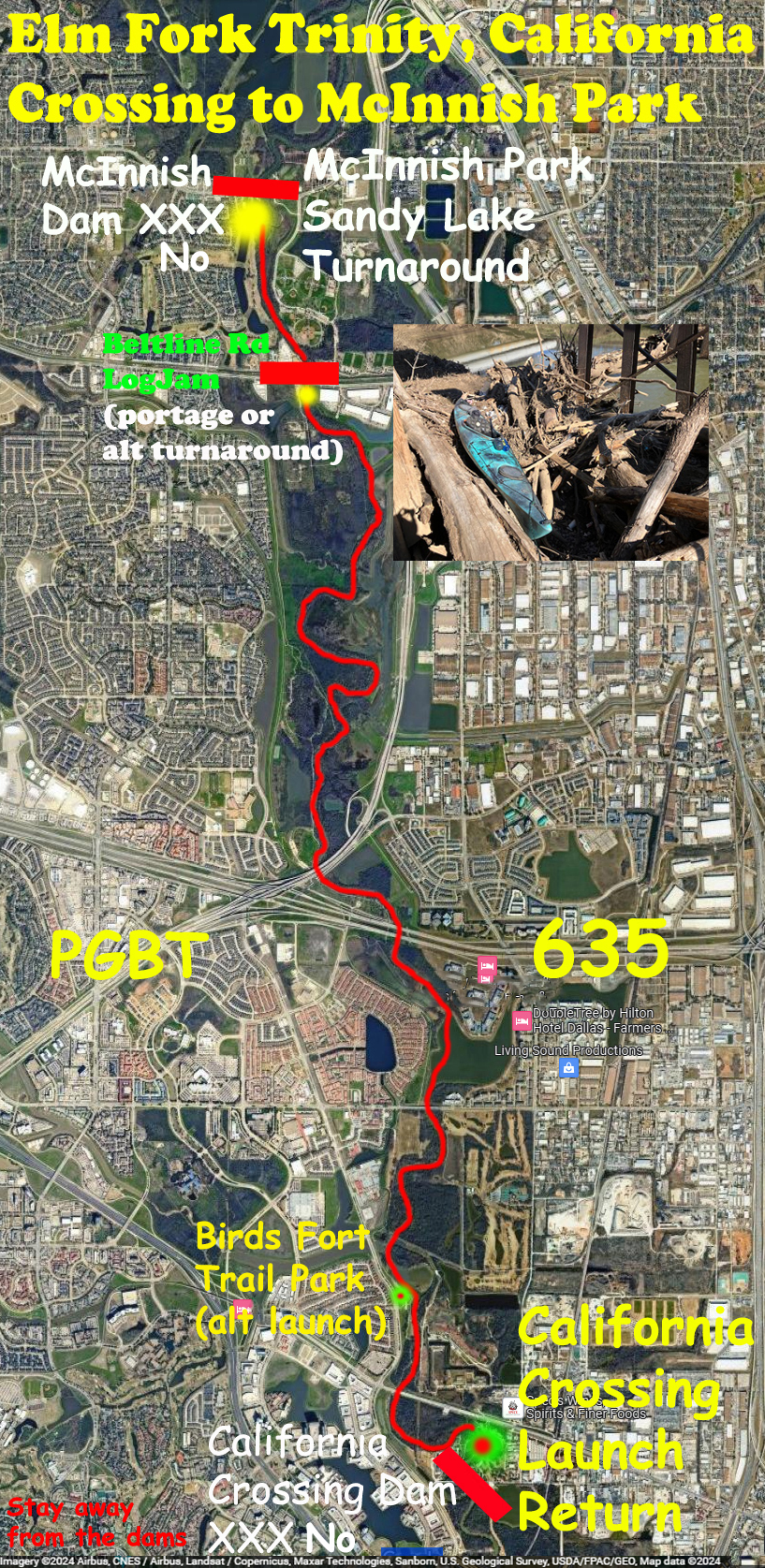
The above leg of the Elm Fork Trinity launches on the upstream side of California Crossing (or at Birds Fort Trail Park) and goes to the McInnish Dam, turning around there for the return leg. There may (sometimes) be a log jam to portage at Beltline Road, as marked on the map. The California Crossing launch is much improved from years ago when it was a sketchy place to park and the water entry was steep on the north side. These days it’s a decent place to launch. Stay away from the dam, strong hydraulics.
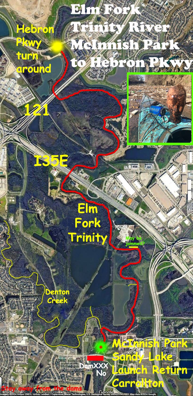
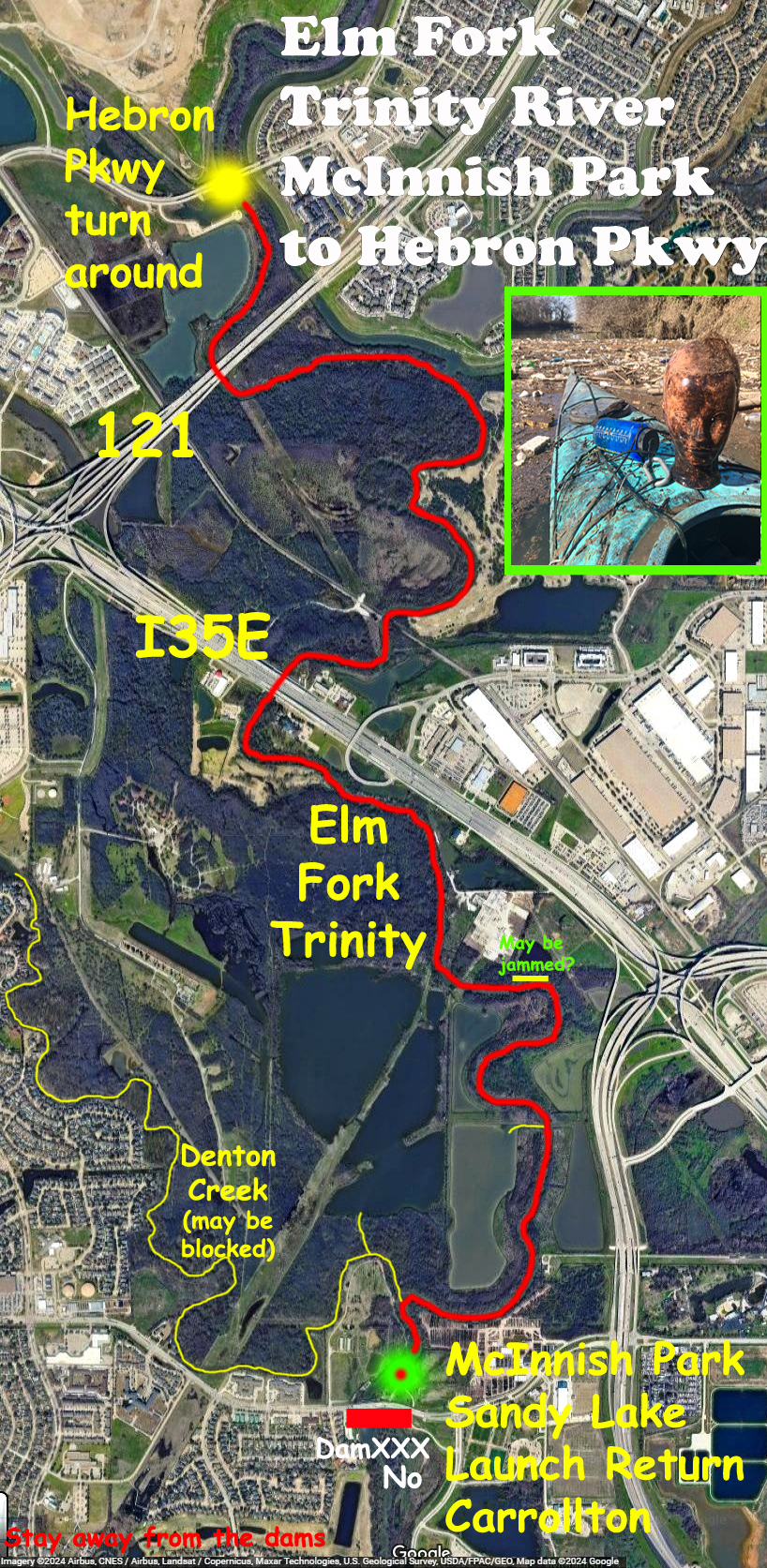
The McInnish Park launch in Carrollton is a popular access point for the Elm Fork Trinity, and the above route starts there, goes to Hebron Pkwy, and returns, a bit under 12 miles total. Lots of folks paddle this section. You can also explore the adjacent lakes, go up Denton Creek to the Grapevine Dam, or go up past Hebron to Lewisville Dam. On trips from this point up I have seen otters, beavers, turtles, coyotes, pigs, deer, bald eagles, mushrooms, black vultures, raccoons, herons, egrets, snakes.
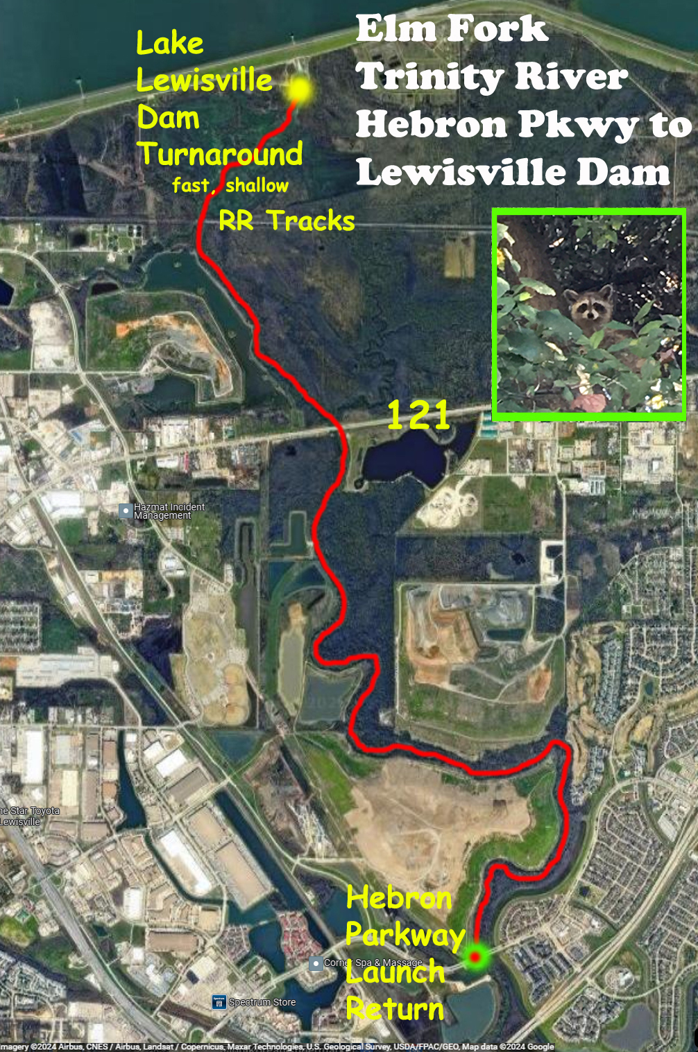
The Hebron Parkway launch is another popular access site for the Elm Fork. From here one can paddle downstream to McInnish Park, or paddle upstream to the Lake Lewisville dam. The section from the railroad bridge to the dam moves pretty quickly and can be a bit shallow so that the paddle blade doesn’t get so much bite, making it a challenge to get ‘all the way’ to the dam. Fun.
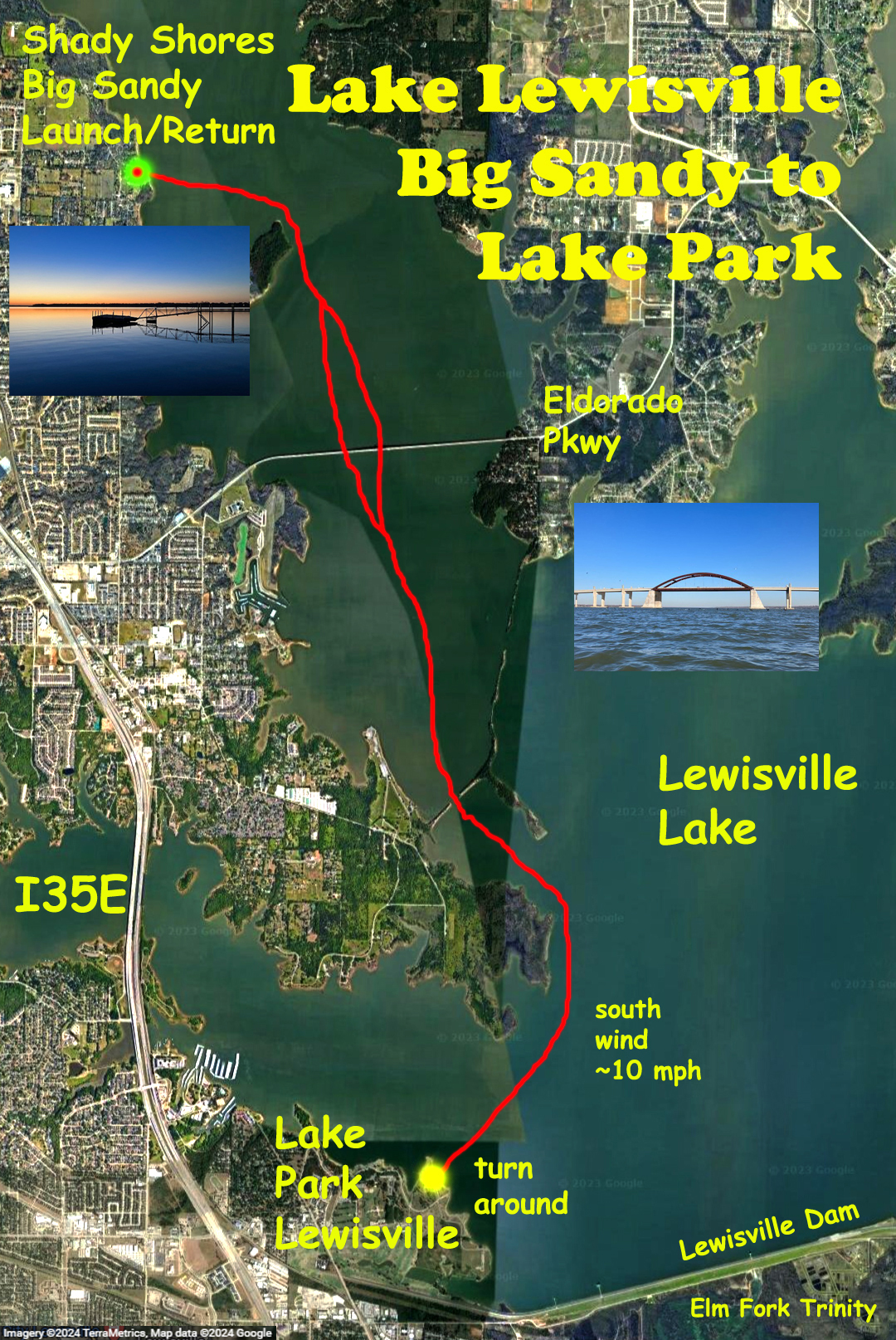
The above section really isn’t the Elm Fork of the Trinity anymore, it’s Lewisville Lake, but it’s here for continuity. This trip was early in the morning in order to avoid the wind, and launches at the Shady Shores/Big Sandy ramp on the west side of the lake. From there I went south under the Lewisville Bridge, ending finally at Lake Park in Lewisville near the dam. I was on the shore at Lake Park maybe three minutes, resting, eating a sandwich, when the park cop sounded his siren and started flashing his lights and motioned me up. I walked over, paddle in hand, to see what’s what, and he told me to get out of the park! Oddest thing. So I launched, sat in the boat for a bit, and headed back. Note that lake paddling is dangerous, its advisable to stay near the shore.
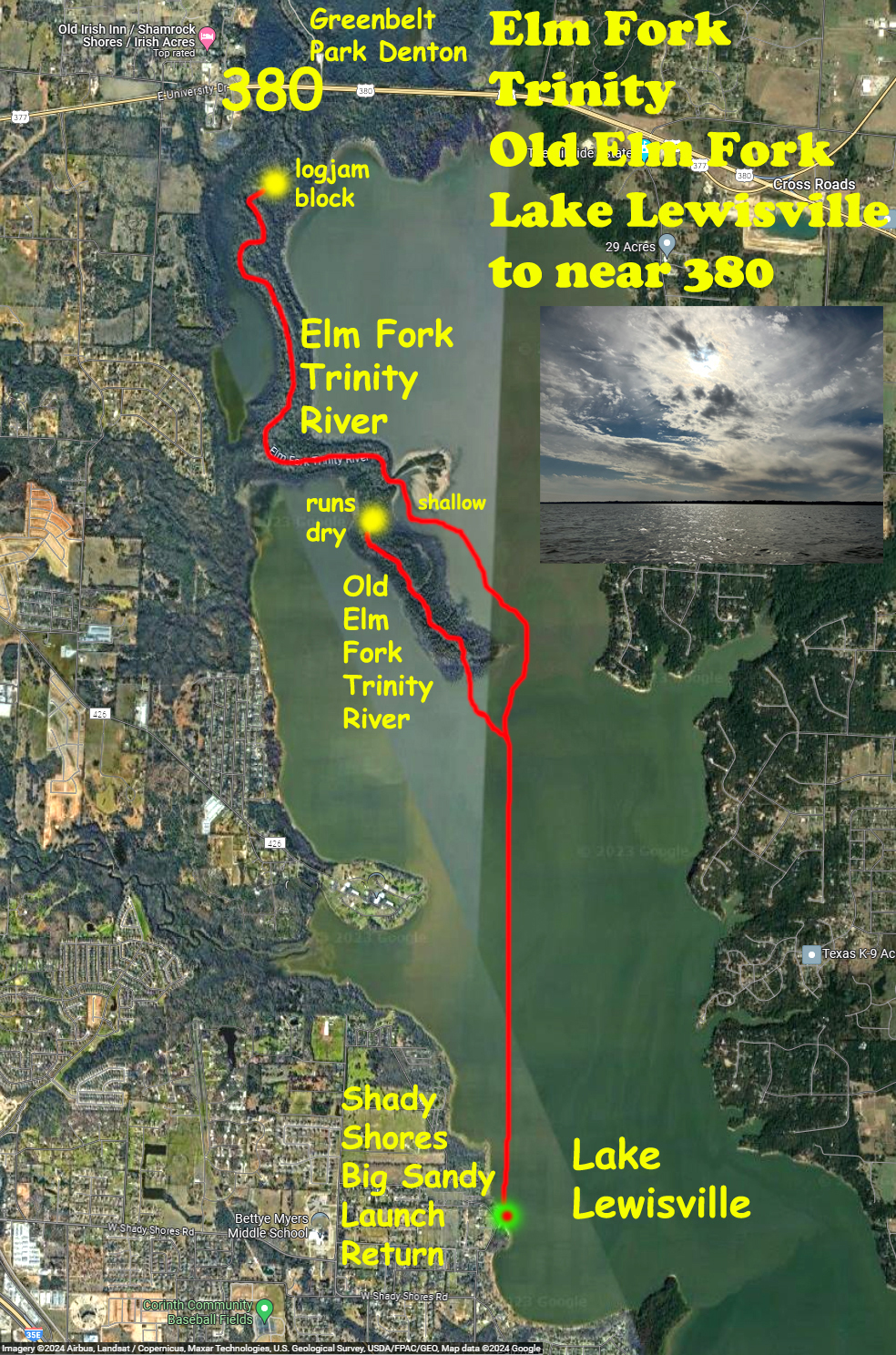
The map above shows a route that runs from the Shady Shores/Big Sandy launch north across Lake Lewisville into the Old Elm Fork and (new) Elm Fork sections of the Trinity. The Old Elm Fork channel is at a tip of land and easy to locate. This can be paddled up to the point where it runs dry, and is surprisingly pretty, I’ve always liked this bit. The entrance to the real Elm Fork is further up on the west side and is shallow at the entry point. You can go up the Elm Fork a ways but there is a big log jam that blocks the river before you reach 380. Lake paddling is dangerous, its advisable to stay near the shore.
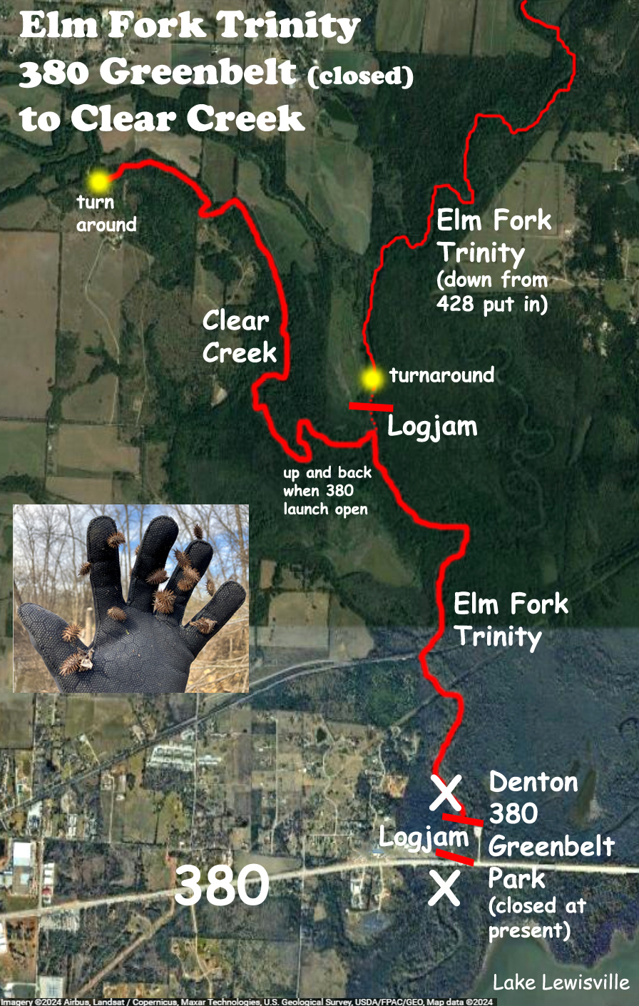
The launch site for the Elm Fork on the 380 Denton Greenbelt has been closed, on and off, for years because of flooding and the presence of a large log jam. The route above was done several years ago on a day when the parking lot was open. But because of the logjam it was necessary to drag the boat north a ways first in order to launch. Further upstream there is another large log jam on the Elm Fork and so the route shown splits to go up Clear Creek.
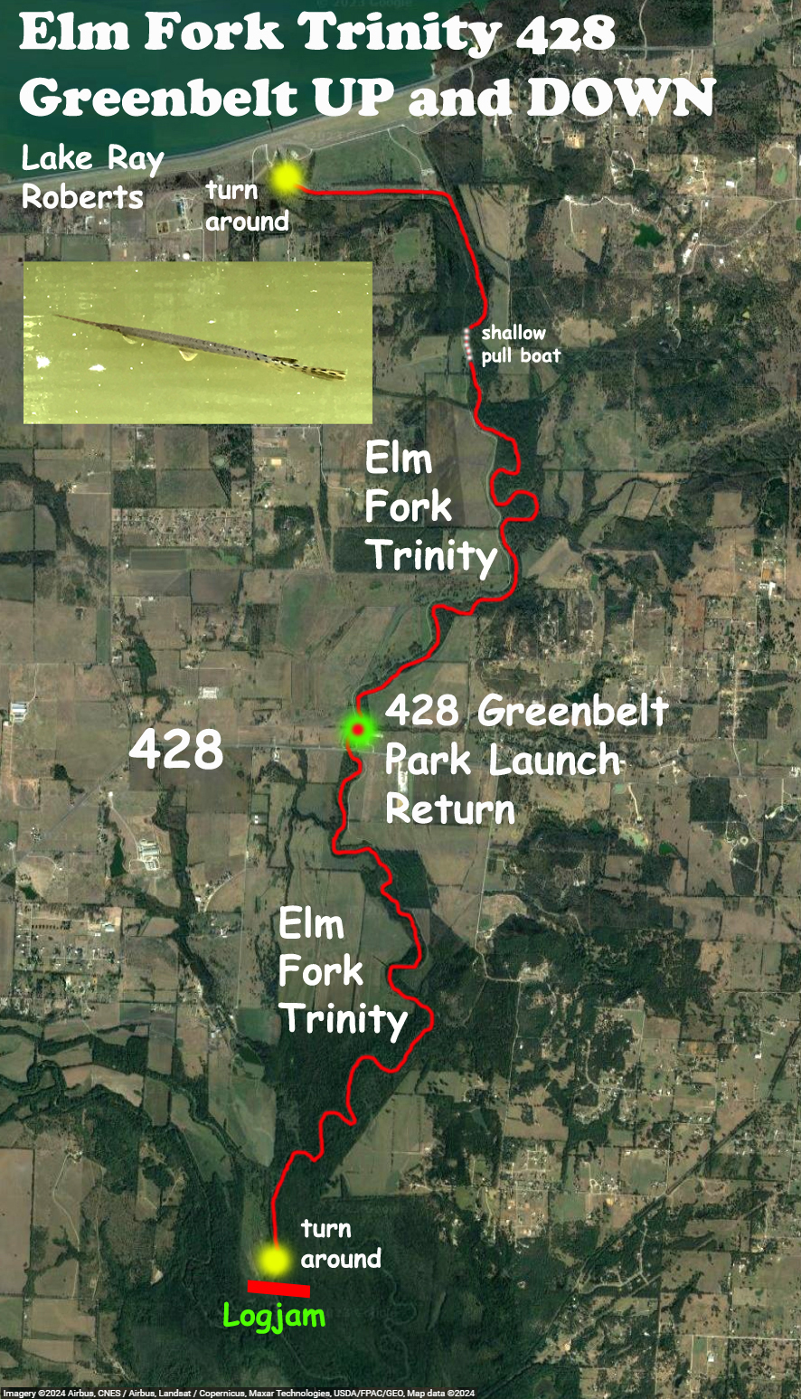
The most northerly launch for the Elm Fork of the Trinity (in this set) is at the 428 Greenbelt lot. It costs a few bucks or requires a state park pass. The launch is down a steep set of stairs to the river. From there you can paddle upstream to the Ray Roberts Dam, or downstream to the point of the log jam near the Clear Creek junction. This is a nice, remote, wooded, paddle where you can usually see some wildlife such as deer and pigs (if pigs are wildlife) and usually lots of gar. I haven’t done any of the Elm Fork above Ray Roberts so that is not included here.
