Blind River, Maurepas Swamp WMA, St. James Boat Club B
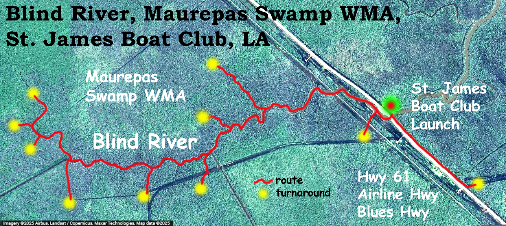
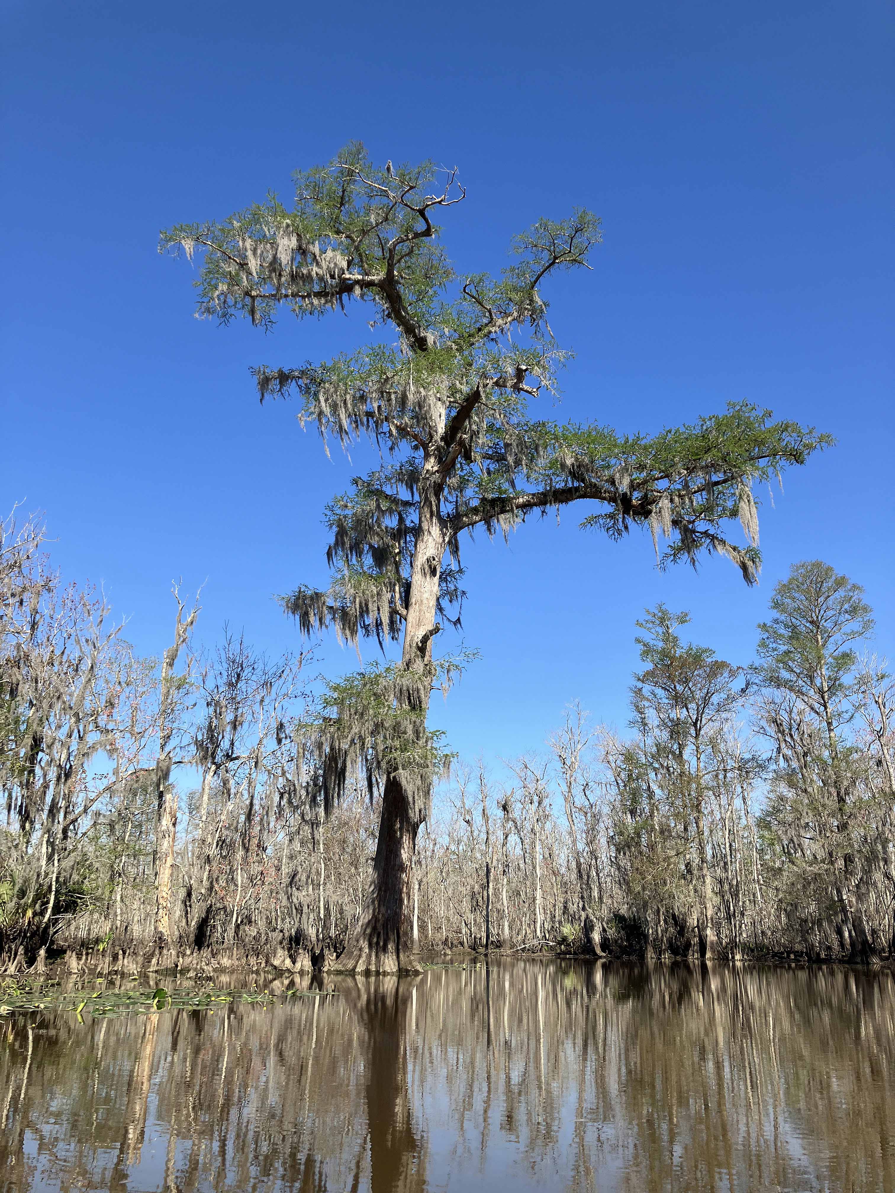
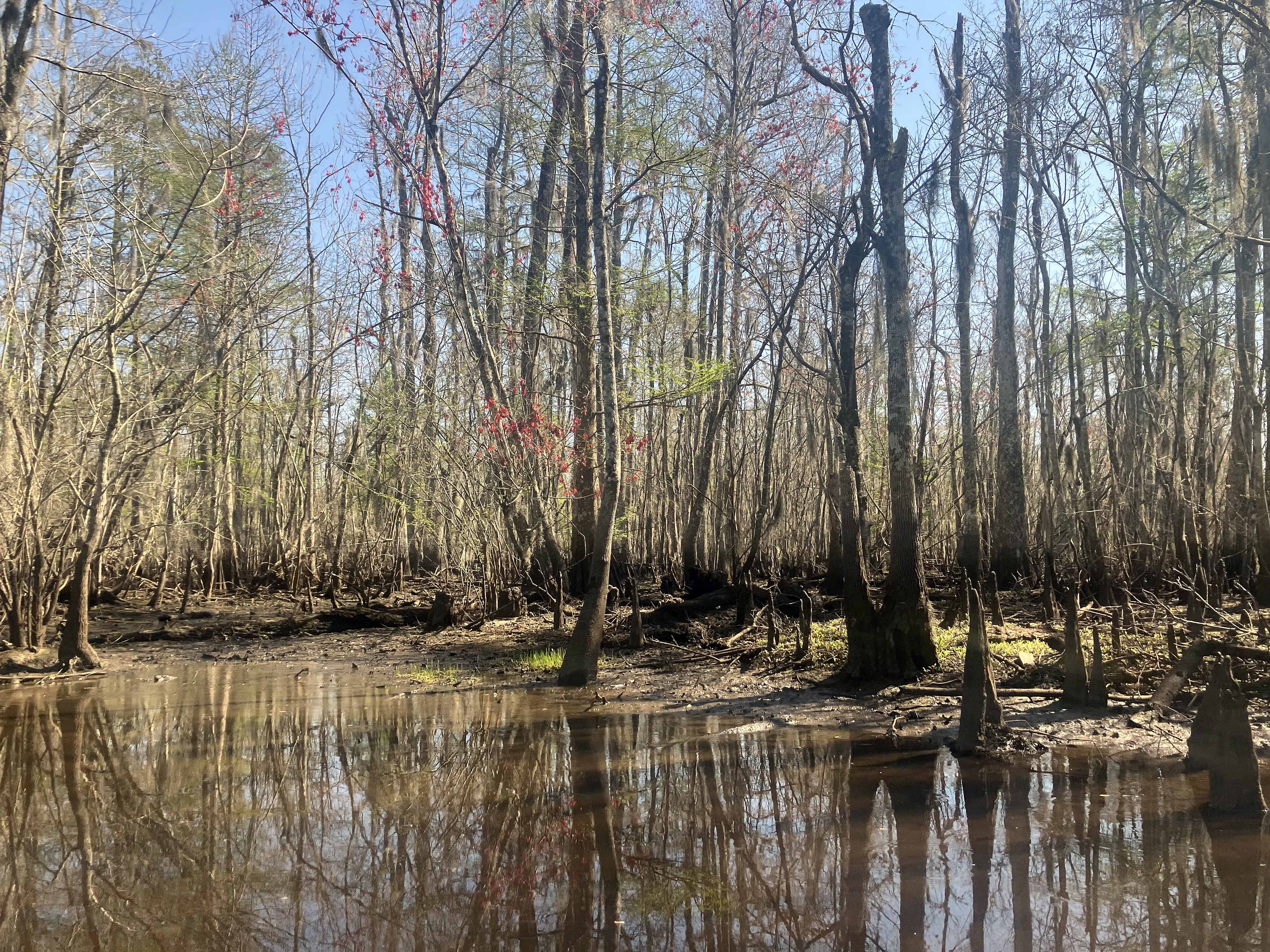
Kayak route paddle map leaving from the St. James Boat Club launch into Blind River. The club is just off of Highway 61, aka Blues Hwy, aka Airline Hwy. This was the second trip I have done from this launch, and it goes west under the Highway 61 bridge to explore Blind River and any sloughs and channels that enter in. This area, the Maurepas Swamp WMA, is one of the better spots swamp paddles in the New Orleans area, I think. There are large cypress left over from logging which are wonderful to see, the side channels get into the swamp pretty well, and there are lots of alligators. This trip I also saw a bunch of otters digging for shells and snails in the silt. On an earlier trip here the Airline Canal gage was about 0.9; for this trip the gage was at about 0.0. This is a bit low and so the shoreline was muddy and progress into the swamp tended to stall in silt and low water. And at some point the boat high centers on logging debris every few feet. Another foot on the gage and the range of paddle exploration would increase tremendously. But either way this is a great place to paddle.
I chatted with a uniformed LDWF guy at the launch about navigability and boat access rights in Louisiana. He said it was super complicated and different than in the other 49 states. Even the enforcement guys weren’t always sure when water was accessible and navigable to all and when it might be private, as the courts have decided it differently from case to case. He said he himself had been kicked out from fishing areas that were clearly and obviously public, by landowners who claimed it was theirs. And sometimes fences and posted signs claim ownership of water that is actually open to everyone. Similar comments about this issue were made by a kayak guide at the Old US51 launch that goes into the east side of the Maurepas Swamp WMA. On the other hand, you do see canals that are posted by petroleum companies, there is one near the Lake Fausse Pointe State Park boat launch, and my understanding is that those are indeed private. Things to consider.
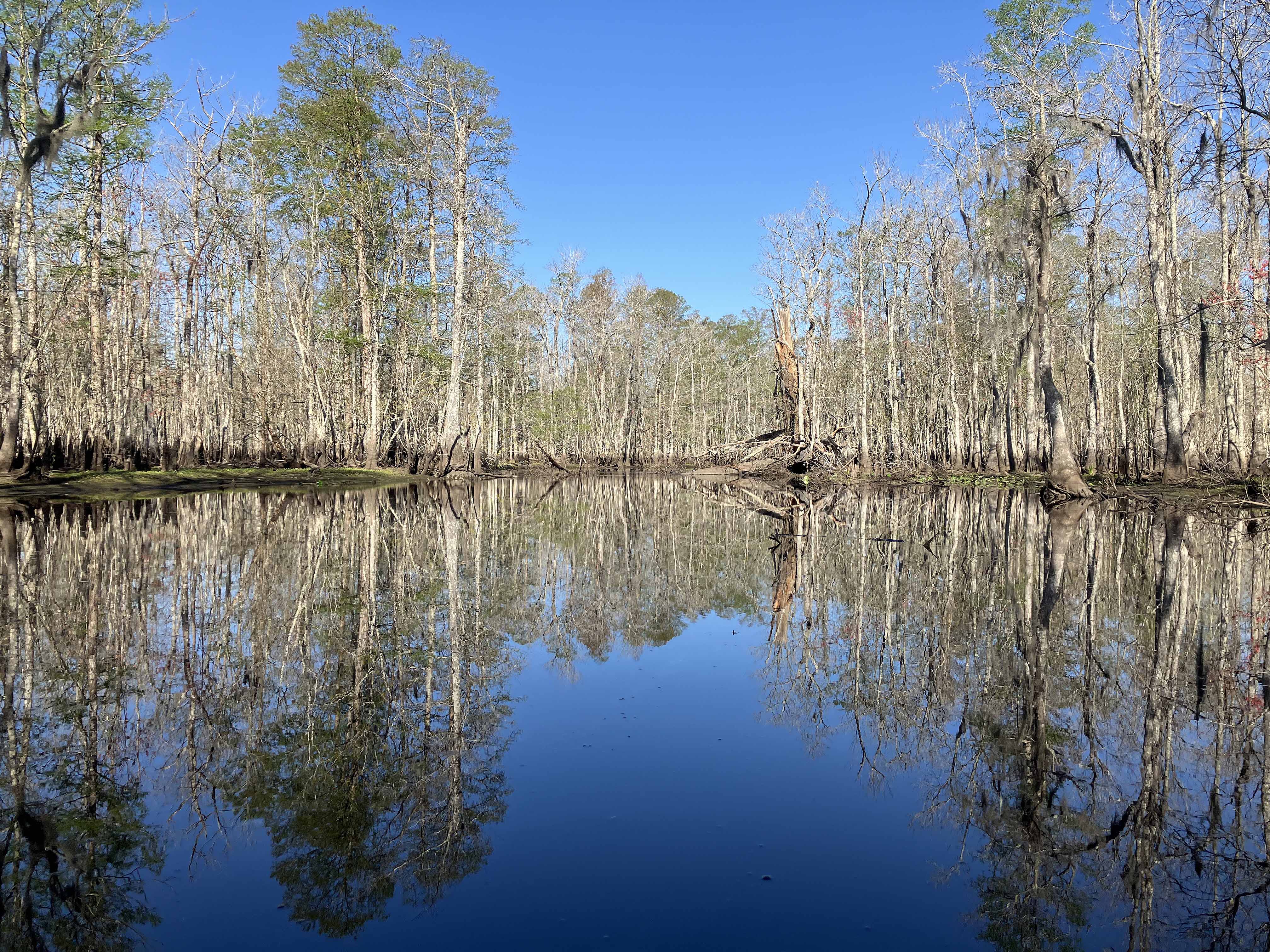
Above: Explosion of brown and grey.
Above: If only there were more.

Above: These two footers are sometimes pretty bold.

Above: Boom!
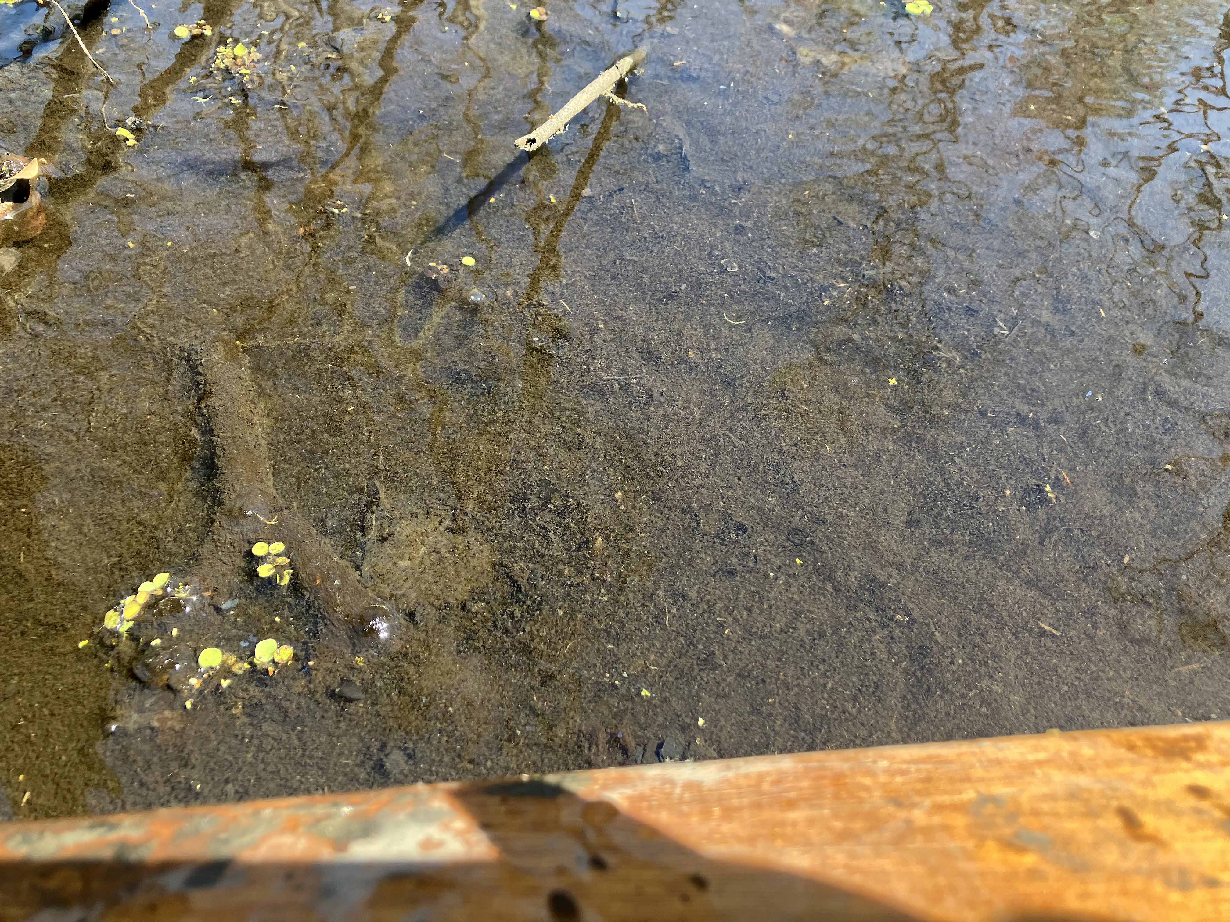
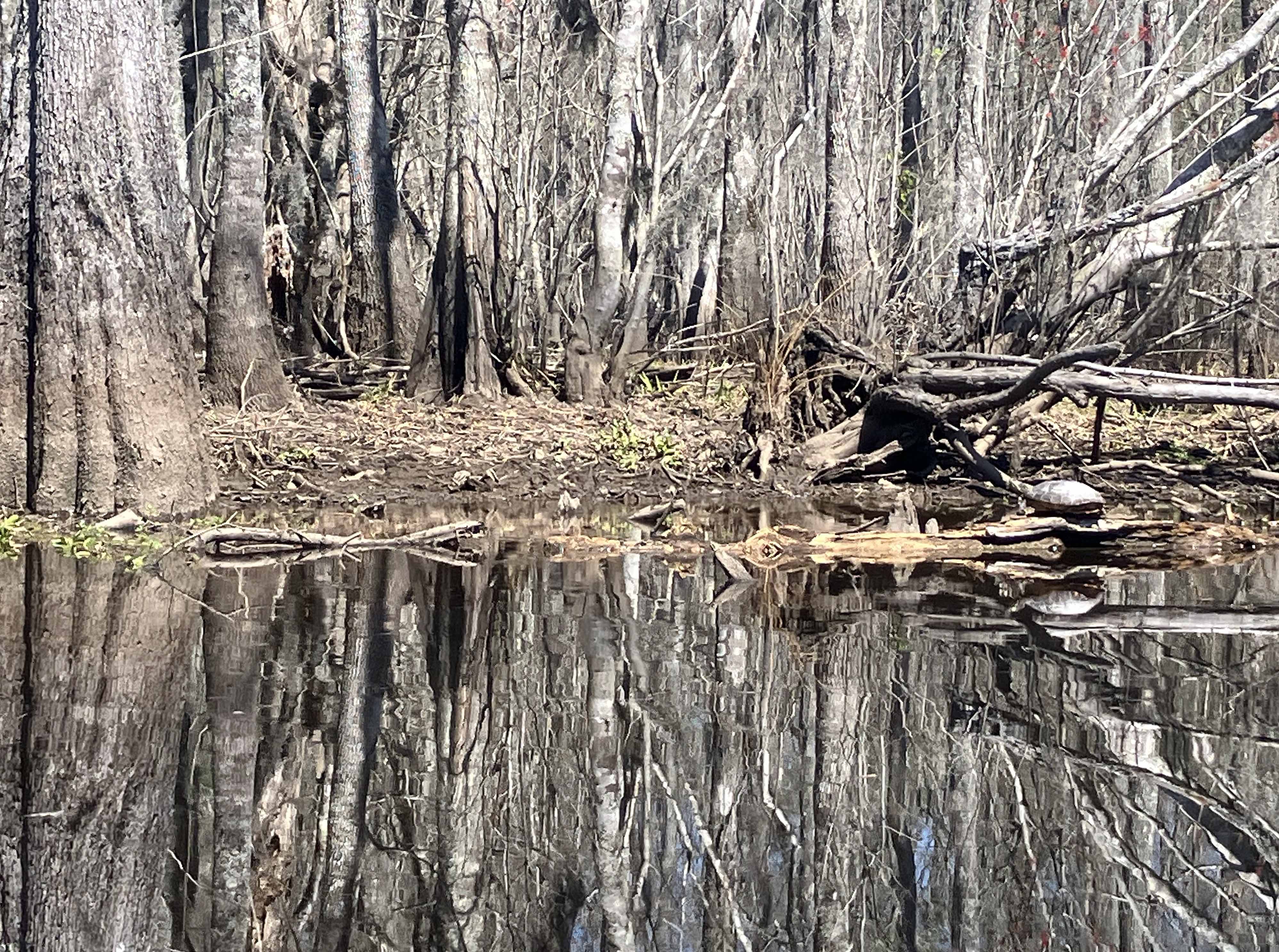
Above: The side channels were this…loose silt. Paddle strokes were in the silt, which could be a few inches to a few feet deep. Hard going sometimes, and muddy if you get out.
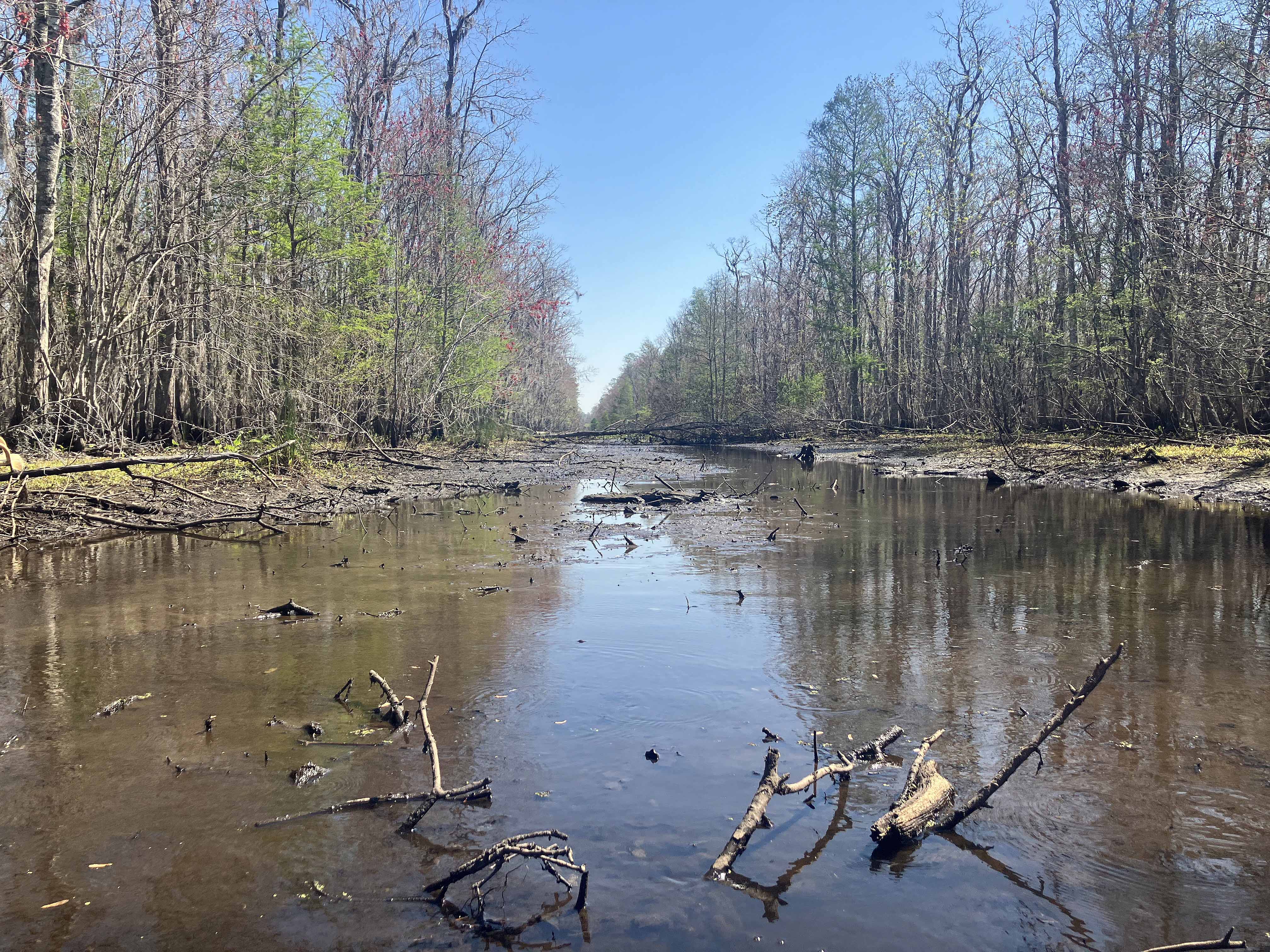
Above: A canal intersecting one of the side sloughs looks paddleable by satellite map but at this water level is just too low. But a good depiction of how the area looks when the Airline Canal gage is 0.0.
